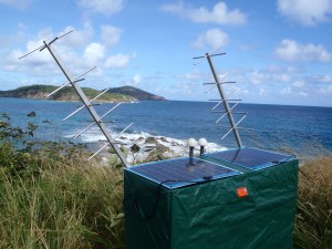
 JOA Surveys, LLC (JOA) owns an array of water level monitoring systems (tide gauges) that meet or exceed the NOAA accuracy specifications. All of our shore based systems are equipped with radios that transmit tide data hourly to GOES satellites. The data is downloaded to our server and made available on our website for quality control, preliminary processing of survey data or real time water level verification for aerial shoreline mapping.
JOA Surveys has years of logistics experience, successfully moving equipment and personnel to and from the job site no matter how urban or remote, from uninhabited islands in the Aleutians to Key West, Florida. We obtain permits and permissions from private individuals, Alaska native corporations, local, state and federal agencies for every site prior to installation and have made hundreds of connections and local contacts, throughout Alaska and beyond, to get the job done smoothly and efficiently.
 JOA Surveys, LLC (JOA) owns an array of water level monitoring systems (tide gauges) that meet or exceed the NOAA accuracy specifications. All of our shore based systems are equipped with radios that transmit tide data hourly to GOES satellites. The data is downloaded to our server and made available on our website for quality control, preliminary processing of survey data or real time water level verification for aerial shoreline mapping.