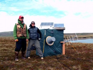
 JOA Surveys, LLC (JOA) specializes in the measurement of coastal tides. We achieve millimeter accuracy in water level measurement with the most precise equipment available and rigorous field procedures. JOA has received specialized water level measurement training from the Center for Operational Oceanographic Products and Services (CO-OPS), a line office of the National Ocean Service within NOAA.
JOA deploys a variety of water level measurement sensors, each able to fit particular environmental conditions or data requirements. Water pressure sensor systems are extremely precise and the most adaptable for remote and rugged coastlines or offshore, but require careful attention to water density and underwater sensor stability. Acoustic sensors must be mounted to a structure such as a dock and entail more construction, but they are extremely accurate and facilitate the leveling tie between the water level measurements and tidal bench marks on land. Microwave radars are non-contact sensors that are relatively new and simple to install, but have reduced accuracy in large waves. Finally, GNSS on platforms at sea such as buoys and boats provides a water level measurement that directly relates tidal datums to the ellipsoid, but requires more extensive data processing.
The water levels measured by JOA can be used to support nautical charting, shoreline mapping, VDATUM development and validation, coastal water boundary determination, tidal datum determination, improved tide predictions, and storm surge modeling.
