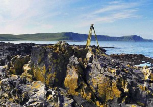
 JOA Surveys, LLC (JOA) has the experience to provide all geodetic survey control needs. We are regularly on the ground performing GPS surveys for shoreline, hydrographic, LiDAR and photogrammetric mapping. Our surveys have been as simple as single point occupations with OPUS solutions, to complicated networks with dozens of occupations spanning hundreds of kilometers post processed to NGS specifications. Occupations have spanned anywhere from a few minutes to a month or even more. We are able to survey in the most remote locations in Alaska, where access may be by plane, helicopter, boat, atv, skiff, or even by foot.
Data processing is typically performed using the various NGS tools. In addition to the online processor OPUS, we regularly use NGS PAGES, ADJUST, OPUSDB and now OPUS Projects for our formal submissions. JOA partners have been formally trained by the NGS and we can fully meet NOAA submission requirements.
JOA can also provide rapid surveys and reporting requirements. We have recently added fully integrated RTK units to our inventory. For rapid processing, we offer Topcon Tools and Trimble Total Control software packages.
