Though JOA Surveys is based in Alaska and invested in improving the tide and elevation basemap in our home state, we offer expertise broadly and excel in remote and logistically challenging locations. Our services have taken us to Rose Atoll, Wake Island, Puerto Rico and the Virgin Islands, to name a few. This summer JOA installed a tide gauge in American Samoa and surveyed tidal benchmarks on four islands. The project was funded by the USACE and done in collaboration with NOAA.
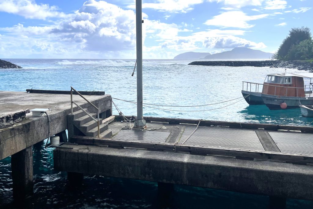
T’au Small Boat Harbor, Am. Samoa: A lightweight and discreet radar tide gauge measures and transmits 6 minute data. Two RBR underwater pressure gauges fixed below the dock measure the tide as a backup system.
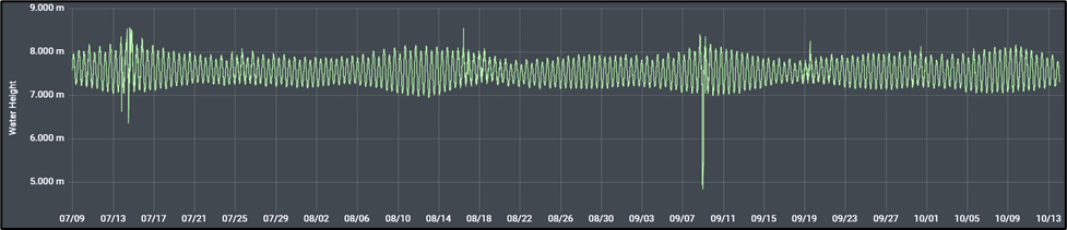
Three months of water levels were collected. Noisy data on 7/14 and 9/8 reflects storm events.
Like the Hawaiian Islands, the islands of American Samoa are formed from volcanic activity and these low lying volcanoes are potentially active. Subsidence due to seismic activity, coupled with erosion and sea level rise, increase vulnerability to storm surge. Surveys and sea level measurements provide a baseline for understanding the rate of change in the land and sea level, allowing agencies and communities to plan for problems associated with climate change and relative sea level rise. The data is foundational for coastal engineering and planning.
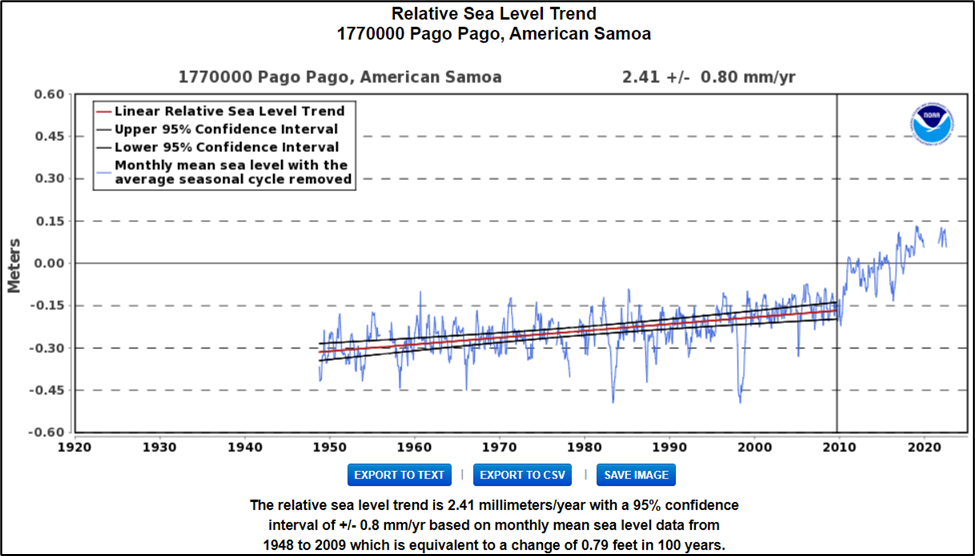
Sea level rise in American Samoa is compounded by post-seismic subsidence of the land. The ¼ meter (10”) jump in sea level follows a September 2009 earthquake. https://tidesandcurrents.noaa.gov/sltrends/sltrends.html
While in American Samoa our team witnessed a severe weather event in conjunction with the high tide cycle. This “King Tide” on July 12th, damaged two of the three major airports, destroyed plantations, and flooded homes. Locals had not seen this type of weather event before and the damage created fear and concern for the future of the islands.
Several days later the islands of T’au and Ofu began experiencing about 20 earthquakes an hour. A seismology team responded and instituted monitoring systems across the islands. T’au was put on volcano alert and government and local authorities cleared tsunami evacuation routes and practiced response plans. On October 3rd, USGS lowered the advisory to normal, but monitoring continues, and the American Samoan Government maintains a state of concern.
Response for these types of events is refined through collaboration. While on the island of Tutuilla, JOA leveled to NOAA’s permanent tide station which had been rebuilt during COVID, and offered to repair the broken permanent GPS station (CORS station). In T’au the team adjusted the GPS Receivers for USGS, and gave NOAA, USGS, and the University of Hawaii an option to keep T’au tide station in place as an early tsunami warning indicator. All GPS data was submitted to the National Geodetic OPUS database to make it publicly available for future use and water level measurements were performed to NOAA specifications so that they could be used to improve tide predictions and storm surge modeling.
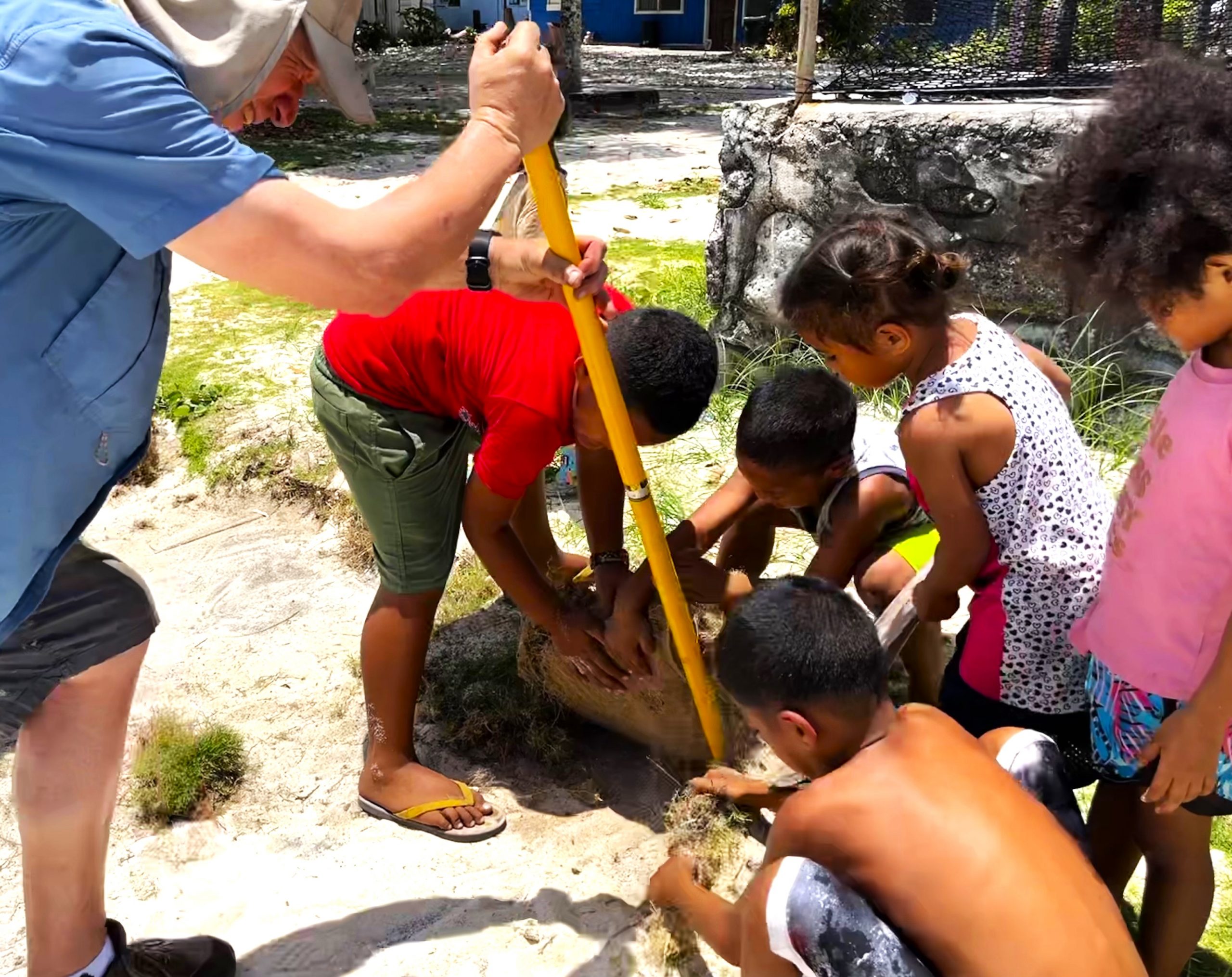
Though American Samoa is no exception to the challenges associated with collecting data in remote locations, our team experienced unbelievable hospitality and support from locals. Contacts across islands monitored scientific equipment, provided housing, transportation, and food, and assisted as questions and dilemmas came up. Even children helped. “It is the American Samoan way- in Manu’a you show up with $5.00, and at the end of your visit, you will still have $5.00” an elder chuckled. Our team was humbled and grateful for the example in generosity we experienced. It is JOA’s hope that the work we accomplished can be tied into future data collection and be beneficial to the daily life of our friends in American Samoa.